Back home
Post #274

RU POV: Russian and Ukrainian advances from Day 1533 to 1538 of the War - Suriyakmaps

May 6, 2026 — May 11, 2026 War Day 1533–1538

There will be some weird updates in this one due to some flag raising during the few day ‘ceasefire’ (not really) for Victory Day. Some of these are just confirming long known control, but there were some newer ones that showed the front had slightly shifted.

------------------------------------------------------------------------------------------------------

Pictures 1 to 13 are from Day 1533 to 1538 (Wednesday 06 May to Monday 11 May).

------------------------------------------------------------------------------------------------------

A reminder that these maps are confirming updates from previous days (i.e. typically 24 to 72 hours delayed from each day).

Live map can be found here, Suriyak’s twitter can be found here.

Ukrainian Advance
34.54 km²
Overall (set): 35.14 km²
Russian Advance
38.69 km²
Net Change
-4.15 km²

Situation Snapshots

Imagery, commentary, and territorial changes from the period.

21 entries
Russian Forces Advance: 4.05 km²

Advance = 4.08km2

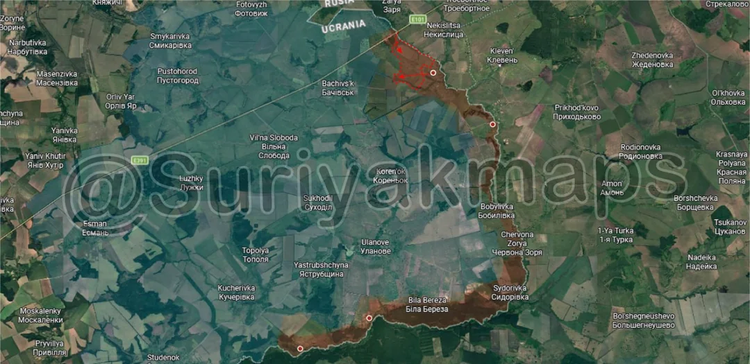
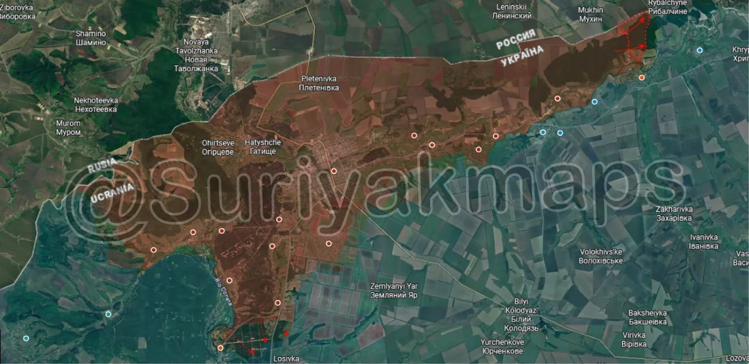
Beginning on the Sumy front, over the past week Russian units managed to capture the fields and treelines between Sopych and the border checkpoint, both of which had been secured quite some time ago. This region has significantly calmed down since the initial Russian crossings in February and March, though there remains a minor level of clashes and some positional battles between the troops operating here.
Russian Forces Advance: 2.94 km²

Advance = 2.97km2

Onto the northern front, on the northeast side Russia has made a small advance in the forest north of Orhrimivka, whilst fighting continues over the village.

To the southwest, with their initial assault on Verkhnya Pysarivka petering out (only partially captured) Russia has started new attacks east of the village, aiming to gain control over the section of the forest north of the Pilna River.
Russian Forces Advance: 0.35 km²

Advance = 0.35km2

Over on the Oskil River front there were some newly released flag waving videos in several areas during the Victory Day ‘ceasefire’. On the northeast side Russia once again showed its control of Nadiya, which they captured last year, although sporadic fighting does occur west of the village.

To the south, Russia was also shown to be in central Tverdokhlibove, a tiny village of less than a dozen houses. Whilst they don’t control it they are least present when they weren’t before, so it’s a minor advance that could have occurred anytime in the past few months. I don’t expect them to put much effort into capturing it as this is a tertiary front and not one either side is particularly active on.
Context
Russian Forces Advance: 3.00 km²

Lower Left Advance = 1.15km2, Bottom Left Advance = 1.85km2

Continuing on from the previous picture, Ukraine demonstrated their control of Hrekivka, which they have held tenuously for quite a while now.

To the southwest, Russian troops were shown to control Novomykhailivka, another tiny village that looks to have changed hands sometime in the past few months (Ukraine couldn’t consolidate here after their assault several months back). Like Tverdokhlibove this means little for this frontline as neither side is really trying to advance, only hold their positions and probe the other.

To the southwest, Russia recaptured the remainder of eastern Karpivka sometime over the past couple of months. The village has been fought over on and off again for almost a year at this point, although the vast majority of that period has seen no fighting. Ukraine recaptured the east side of the locality late last year but Russia pushed back in months after. Naturally with them only controlling a small foothold on the east side of the Nitrius River and not actively pushing Ukraine could not hold onto it and eventually were forced back to the other side. Currently there is minimal fighting here and only occasional clashes as individual infantry groups from Russia or Ukraine cross to the other side but are forced back, so I do not expect much to change here anytime soon.
Context
Context Advance: 2.12 km²

Advance = 2.12km2

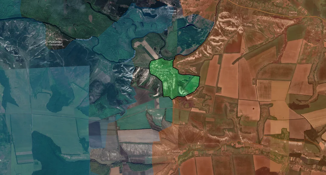
Down to the Siversk front, after a few more days of clearing Russian assault groups captured Kryva Luka. They’ll need to work on clearing out the nearby hills and consolidating further before the settlement is secured, but it will help them break the deadlock on the other side of the Siverskyi Donets River by threatening to cut off the Ukrainian forces in Ozerne from behind (above the advance).
Context
Context Advance: 2.74 km²

Upper Left Advance = 1.34km2, Lower Left Advance = 1.40km2

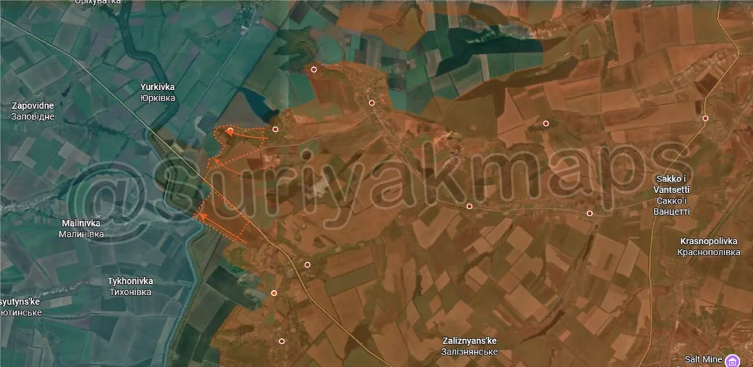
Heading to the southern side of the same front, Russia made further advances around Holubivka and Fedorivka Druha, managing to capture Dibrova and also securing part of the east side of the canal (had been unable to despite weeks of attempts). They’ll be looking to capture the area around Dronivka and the remainder of the canal in this area to properly secure this section of the frontline and opening the way for attacks into Malynivka and Tykhonivka.
Ukrainian Forces Advance: 14.32 km²

Top Advance = 0.51km2, Left Advance = 13.81km2

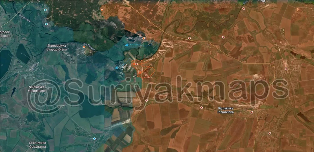
Moving to the Chasiv Yar front, on the north side Russia finally moved further into Markove after a months long standoff where neither side could control the village. They’ll still have difficulty securing it as long as Ukraine controls the hill immediately to the north, so until they can drive them out we’ll see Markove stuck in an unstable greyzone.

To the southwest, we finally have an update on Virolyubivka. Back in December last year Russia began pushing towards the village, creating a large greyzone as they began their first assault. This failed with Ukraine counterattacking with several units, however this area has sat in the greyzone ever since. Now five months later we’ve got an update on the fighting here, with Ukraine gradually restoring control over the greyzone within the past few months and resecuring the village. It’s quite unusual, but not entirely rare, for there to be areas where we simply get no information for long periods of time as both sides’ attention is focused elsewhere and no notable events are occurring for them to report on.
Russian Forces Advance: 2.38 km²

Advance = 2.35km2

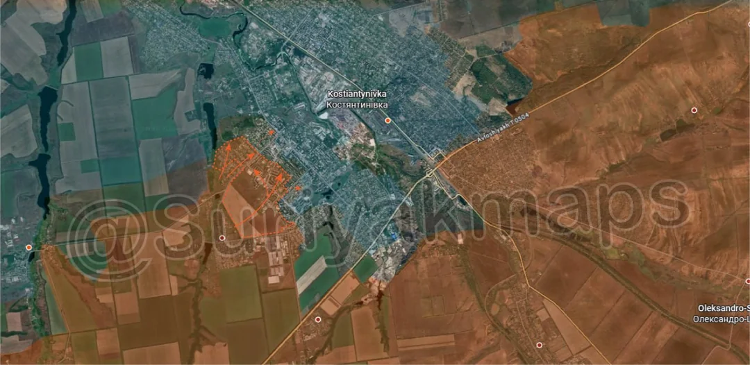
Down to the Kostyantynivka front, within the city Russia reportedly made a series of advances after securing Illinivka, capturing several highrises and residential streets before pushing even further in. This is another Kostyantynivka update where I’ve seen the reports and shellings, but no confirmation of troops on the ground. This doesn’t necessarily mean its fake, as we’ve seen numerous times before, but I can’t confirm this is actually happening until we get more evidence.
Russian Forces Advance: 0.82 km²

Advance = 0.82km2

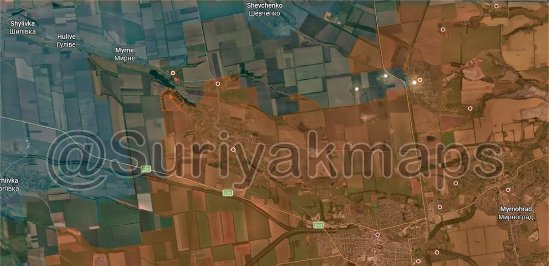
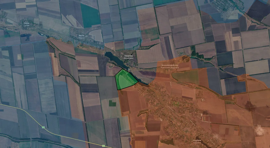
Over to the Pokrovsk front, Russia has moved on from Novooleksandrivka and is heading to Vasylivka, trying to quickly capture the village before Ukraine can reorganise. If Ukraine were to attack Novooleksandrivka they would likely be able to push back into the locality but its questionable if this would be worth it.
Context
Context

No Advance

Onto the Novopavlivka front, there have been no real changes here in many months, with the focus being on the town itself. Russian troops do occasionally cross into Biliakivka, but they do not consolidate in this tiny village and tend to withdraw shortly after. Whilst there aren’t many Ukrainian troops here the lack of Russians mean they have been holding primarily with drones and artillery.
Russian Forces Advance: 4.86 km²

Lower Left Advance = 3.39km2, Lower Middle Advance = 1.46km2

Moving to the Pokrovske front, the past few weeks have seen yet another series of positional pushes from both sides with minimal consolidation. Ukraine and Russia are trying to secure Kalynivske and the surrounding fields, neither having much luck (some greyzone went to Ukraine), whilst the same was occurring in the fields west of Pryvilne and Zlahoda (both sides took some greyzone and lost a small bit of territory).

There isn’t much I can actually say about this as its just a frequent back and forth with small infantry groups vying for control over various treelines, but far more dispersed than you would typically see for this kind of battle.
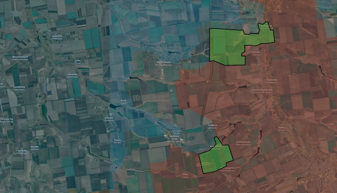
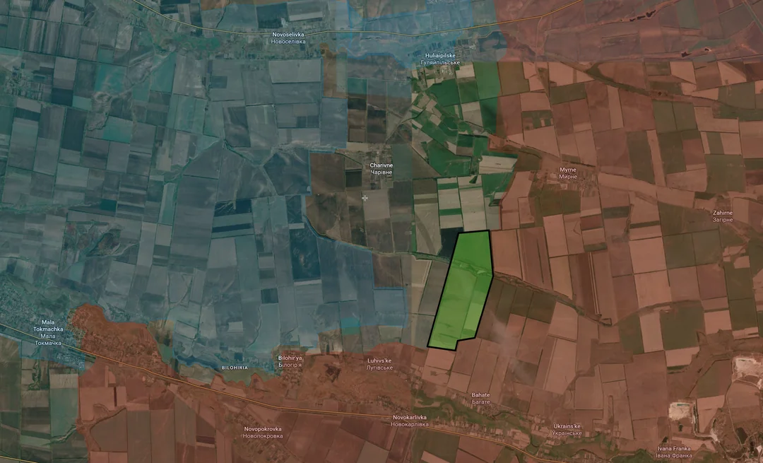
Russian Forces Advance: 20.29 km²

Top Right Advance = 10.89km2, Middle Advance = 4.65km2, Bottom Advance = 4.73km2

Context
Heading to the Hulyaipole front, on the north side Russia managed to recapture Dobropillya the southern side of Dobropillya and many of the treelines around Pryluky over the past week. They are increasing pressure on Vozdvyzhivka (west of this advance) which according to some reports is either partially or mostly controlled by Russia, although I am awaiting confirmation of this.

To the southwest, Russia resecured Krynychne and the surrounding fields and is also ramping up their assaults on Verkhnya Tersa.
Context
Southwest again, Russia has been saturating the large area of fields in and around Huliaipilske and Charivne with small infantry groups, trying to secure the large greyzone that has formed. If Russia can secure both of these village the entire area on their side of the Ukrainian fortification line (dark blue) will fall under their control.
Ukrainian Forces Advance: 8.33 km²

Advance = 8.33km2

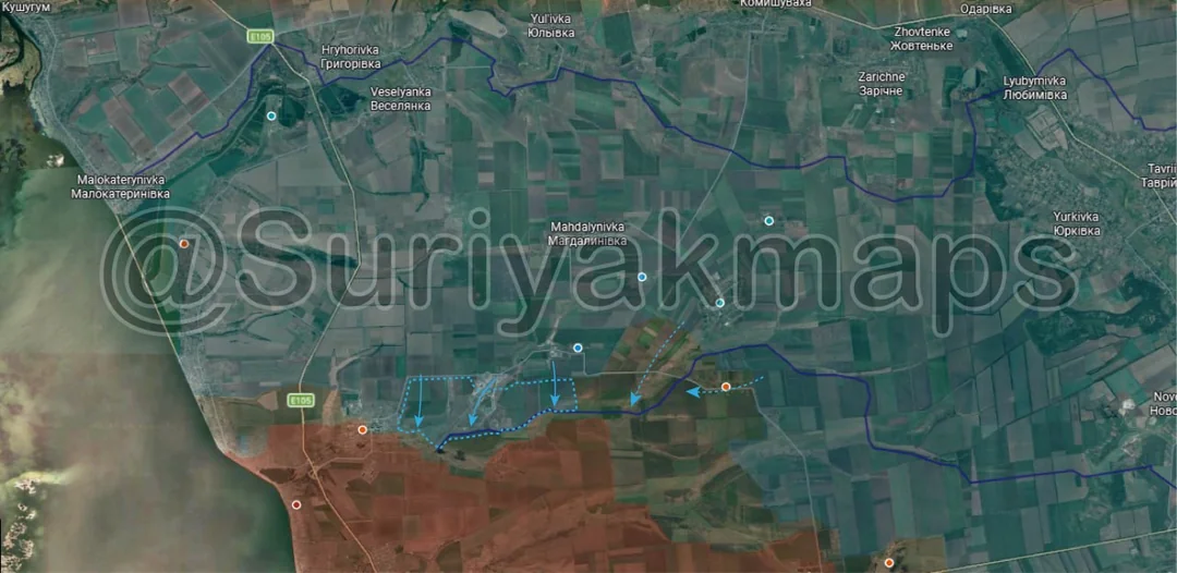
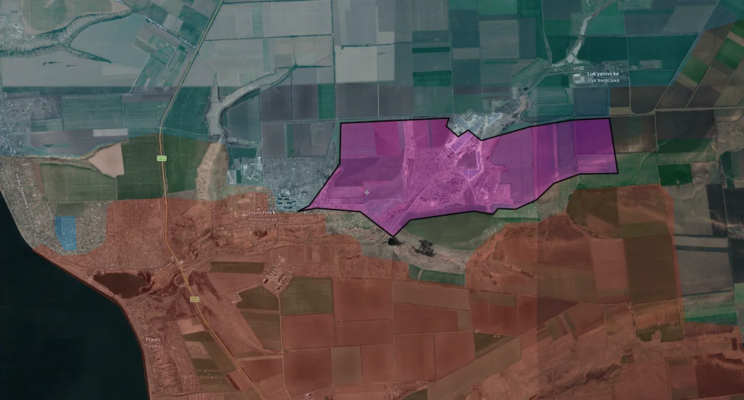
Out to the Zaporizhia front, Ukraine continued their counterattacks, recapturing the solar farm and some of the treelines next to Stepnohirsk. Russian forces are falling back to central Stepnohirsk and northern Plavni, aiming to dig in and try weather the Ukrainian assaults.
Context
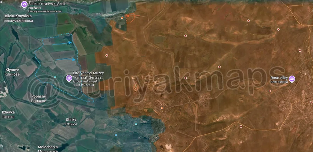
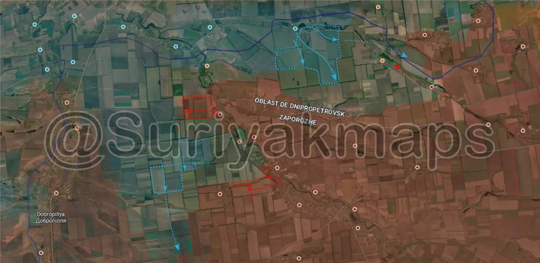
Ukrainian Forces Advance: 11.89 km²

Upper Right Advance = 9.61km2, Middle Left Advance = 2.28km2,