Back home
Post #278

UA POV: Russian and Ukrainian advances from Day 1564 to 1570 of the War - Suriyakmaps

Jun 6, 2026 — Jun 12, 2026 War Day 1564–1570

This post is going to be divisive or at least cause some arguments. This covers the rest of early June through to the middle portion of the month, with Suriyak deciding to do a review of the entire frontline and make numerous changes (some months old). There are a lot of greyzone that has been reallocated, some new overlapping control that makes gross numbers messy and updates that I do not agree with, but I’ll get into that further down.

He has also decided to extend his posting window out to about a week instead of the once every 4 or 5 days he switched to back in January, so updates will come out less frequently than before. Suriyak’s live map is still updated daily so click the link here if you want to see changes before they are formally posted.

------------------------------------------------------------------------------------------------------

Pictures 1 to 17 are from Day 1564 to 1570 (Saturday 06 June to Friday 12 June).

------------------------------------------------------------------------------------------------------

A reminder that these maps are confirming updates from previous days (i.e. typically 24 to 72 hours delayed from each day).

Live map can be found here, Suriyak’s twitter can be found here.

Ukrainian Advance
175.84 km²
Overall (set): 177.19 km²
Russian Advance
117.00 km²
Net Change
58.84 km²

Situation Snapshots

Imagery, commentary, and territorial changes from the period.

17 entries
Russian Forces Advance: 4.00 km²

Top Advance = 3.76km2, Upper Middle Advance = 0.24km2

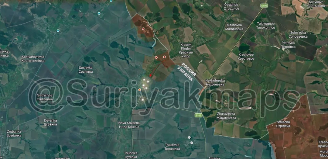
Beginning on the Sumy border area, Russia made another couple of small advances through the treelines west of Sopych over the week and are approaching the village of Bachivsk, although its unclear if they have entered the locality yet. There has also been continued shelling in this region but nothing else notable has occurred.
Russian Forces Advance: 1.50 km²

Advance = 1.50km2

Over to the main part of the Sumy front, Russia made a minor advance in the forest south of Mala Korchakivka, whilst other DRGs fanned out into the nearby villages. I’ll also note I have heard some rumours and vague reports of at least a few Russian groups being further south (off map) operating in the forest somewhere near Sumy city, but I haven’t been able to confirm this.
Context

No Advance

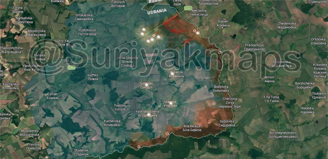
Onto the Kharkiv border area, the Russian groups mentioned in the last post have now entered the outer streets of Kozacha Lopan, where clashes are taking place. For reference this is what the town looks like now, with a lot more tree cover than the map shows.
Ukrainian Forces Advance: 34.39 km²

Top Right Advance = 11.21km2, Middle Advance = 4.57km2, Middle Left Advance = 0.50km2, Lower left Advance = 3.30km2, Bottom Left Advance = 14.81km2

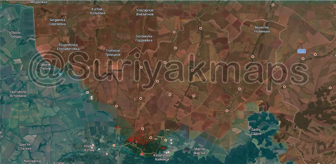
Moving to the northern front, there have been a number of changes made to the map, some dating back to May and others being more recent. Starting with the top right, Russia captured Okhrimivka and Chaikivka, following their reported advances there some weeks ago. This leaves just five villages under Ukrainian control near the Vovcha River here, all of which are becoming increasingly sandwiched between Russian forces to the east and west.

To the southwest, Russia has launched further attacks from Vovchansk and Vovchanski Khutory, capturing some treelines as they try to push the frontlines out into the fields.

Southwest again, after the Ukrainian attacks and infiltrations in May Russian forces have managed to resecure the villages of Lyman and Tseheln, before pushing out into Vilcha again (should be all greyzone).

To the west, through late May and into early June Ukraine continued their counterattacks in the forest southwest of Vovchansk, allegedly retaking Hrafske and pushing the Russians away from Verkhnya Pysarivka and Shesterivka (both only had a few houses in greyzone). This one is harder for me to comment on as there is no footage to back most of this up and many of the reports are conflicting on whether these areas were recaptured properly or currently have mixed control (both sides present). Either way the Russians will need to work on resecuring or pushing back here if they wish to continue taking over the forest as they have been gradually doing this year.
Russian Forces Advance: 14.10 km²

Top Left Advance = 2.88km2, Left Upper Advance = 0.83km2, Right Upper Advance = 2.22km2, Middle Right Advance = 2.77km2, Lower Advance = 2.74km2, Bottom Right Advance = 2.66km2

Heading to the Kupyansk front, we have a number of updates across several areas. Beginning in the north, at some point in the last couple of months Russia regained control of Kindrashivka and has been probing nearby Radkivka. It is unclear whether the Ukrainians who had been attacking the village were wiped out or withdrew due to deteriorating positions, but either way Russia is ever so slowly regaining control over the areas they held around western Kupyansk.

To the southeast, Russia continued working on expanding it’s control over the Kupyansk pocket, taking over more of the last streets of the east side of the town and pushing south from Kucherivka.

Immediately southeast of that Russia has slowly cleared out the last trench networks near Podoly and is working on securing consolidating their positions in the village (so greyzone for now).

Moving southwest, Russian assault groups further pushed into Kupyansk-Vuzlovyi and have secured more of the warehouses and forest area east of the town.

To the south, there were also more DRG movements shown in Kivsharivka and Hlushkivka, making an already messy front even more confusing with mixed control and presence now confirmed in all of the remaining settlements.
Russian Forces Advance: 18.72 km²

Lower Middle Advance = 10.06km2, Bottom Right Advance = 8.66km2

Down south on the Oskil River front we’ve got more confusing and messy pushes by both sides. Starting in the centre (above the a), Russia has made further infiltrations into the forest south of Bohuslavka and parts of the village, aiming to isolate the Ukrainian infantry holding positions in the fortifications and forest area further north.

To the southwest, Ukraine has been launching new attacks towards Borivska Andriivka, recapturing the greyzone that formed last month also moving into the village itself. This is another case where we are lacking footage and it’s unclear who controls what, so for now it seems both Russia and Ukraine are present in this area.

East of this, some Russian soldiers moved south from Zelenyi Hai and entered the village of Shyikivka, which they falsely claim to have captured. The layout of the village is a very stretched ‘C’, so whilst they are present in the northern street it still puts them 2.8km from the main part of the village.
Ukrainian Forces Advance: 35.49 km²

Upper Left Advance = 18.48km2, Bottom Left Advance = 14.14km2, Lower Left Advance = 2.87km2

Onto the southern side of the same front, Ukraine has stepped up it’s offensive that began a few weeks ago. On the north side, the few Russian troops in Karpivka were pushed out of the eastern part of the village, allowing Ukraine to recapture it. They’ve then pushed on into the treelines to the east, launching attacks on Ridkodub, Lypove and Nove. Once again it’s a layered mess here as we have shelling/bombing being conducted by both sides and troops being spotted all over the place, so no one knows what areas are controlled by who.

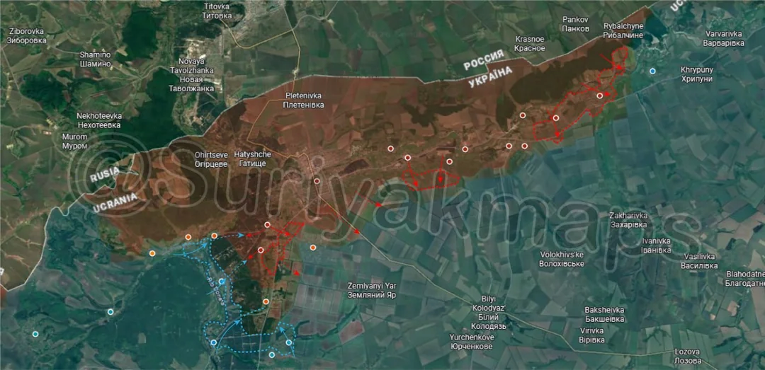
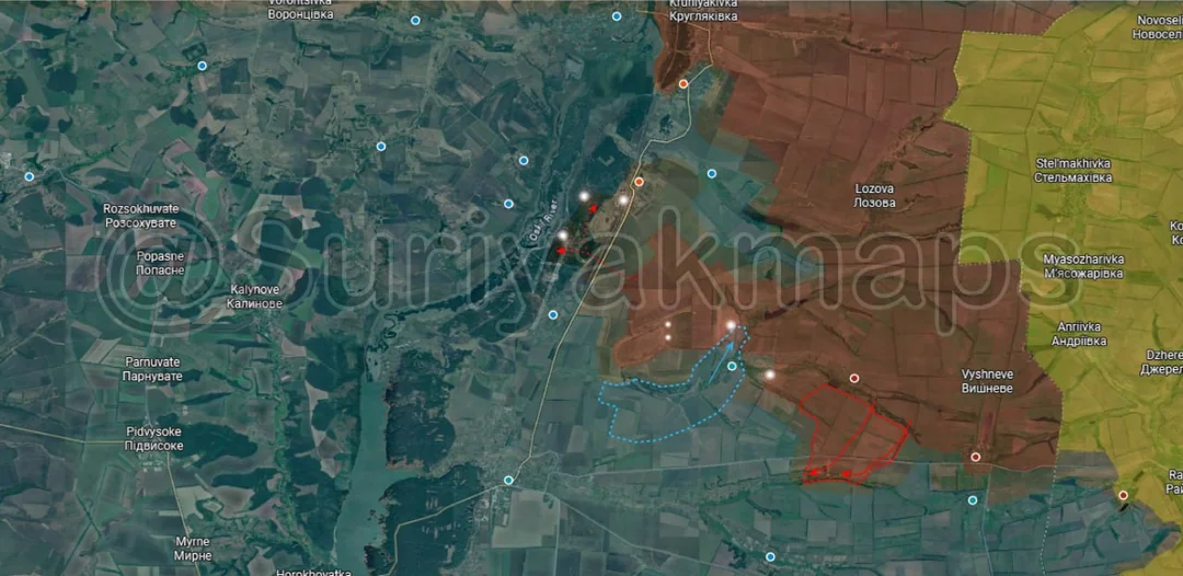
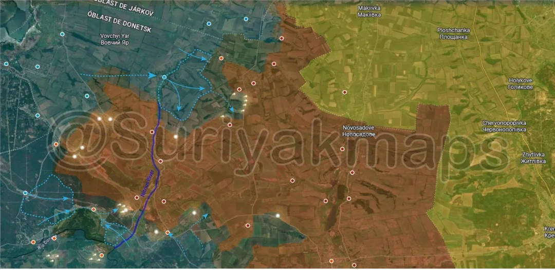
To the southwest, through May and into June Ukraine recaptured much of the forest area near Sosnove once again following a Russian assault a couple of months ago and are now pushing into Yarova from the east and west (mostly greyzone). Russia continues to hold Novoselivka and sends its forces from there into the forest and Yarova, however Ukraine has launched yet another assault in their attempts to drive the Russians back from near the Siverskyi Donets River.

When combined with the advance above it’s clear Ukraine is trying to force Russia out from the area west of the Nitrius River, easing pressure on Lyman. This is easier said than done though as Ukraine has made many attempts to do so since late 2025, so we will have to wait and see if this one is more successful.
Context

No Advance

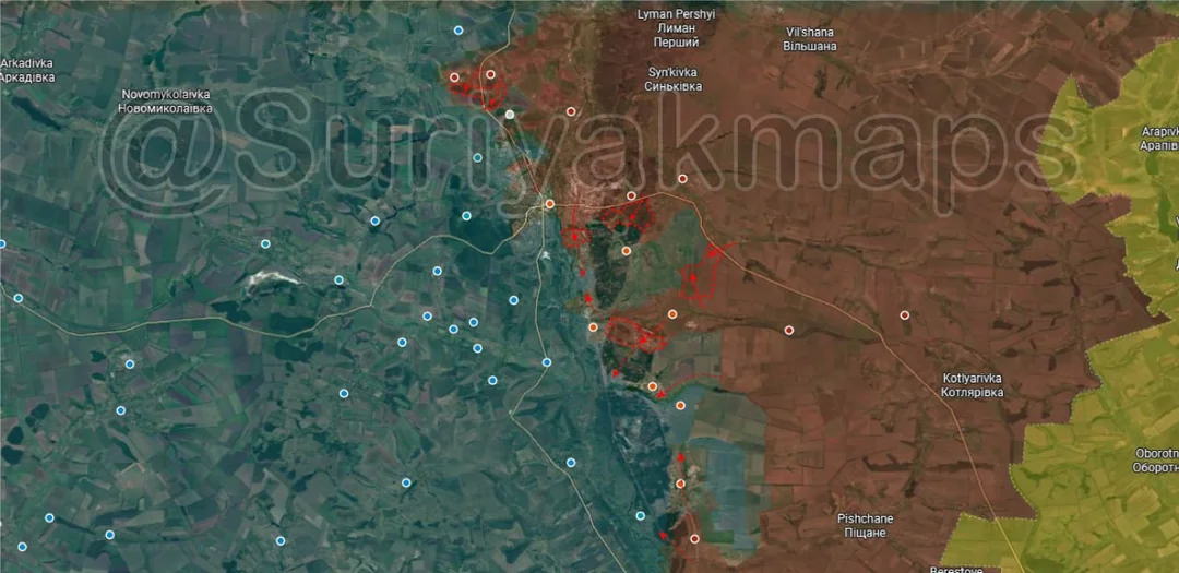
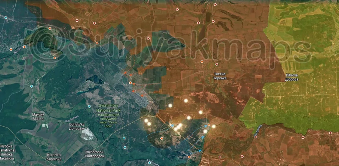
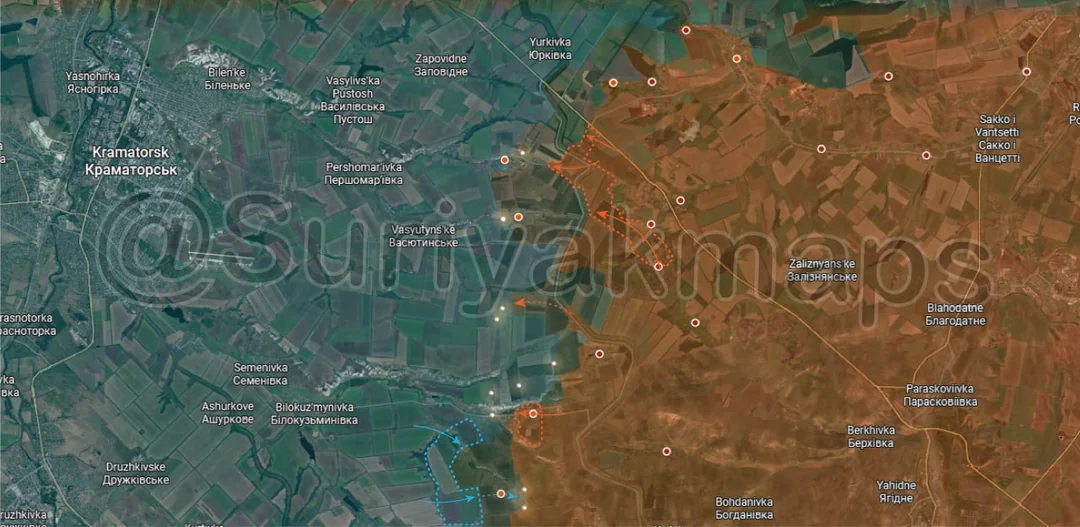
Closely related to the previous picture we also have events quickly picking up speed on the Lyman front. Starting with the southern side of the map, Ukraine intensified their assaults in the national park/forest next to the town, trying once again to flood small infantry groups in and around Ozerne, Dibrova and Yampil as they did in March, April and May. Heavy shelling is occurring all across the area from both sides as infantry groups are clashing with each other trying to gain and/or maintain control.

At the same time as the above and the events in picture 7 Russia has carried out a number of successful infiltrations into Lyman and their presence in the town is growing by the day. Much of Lyman is now in the greyzone and with their numbers increasingly eventually Russia can start consolidating and begin clearing Lyman properly.

So we have a situation where Ukraine is aggressive assaulting the areas north and south of Lyman to try relieve pressure and push the Russians back, whilst the Russians have simultaneously gone straight into the town and are funnelling more infantry in. We obviously cannot tell if the soldiers Ukraine is using for the attacks north and south of Lyman were originally part of the garrison, but them being deployed and engaged in attacks on the flanks has certainly left Ukraine with fewer options to respond to the Russian infiltrations.
Ukrainian Forces Advance: 10.53 km²

Middle Advance = 9.06km2, Bottom Left Advance = 0.86km2, Bottom Advance = 0.61km2

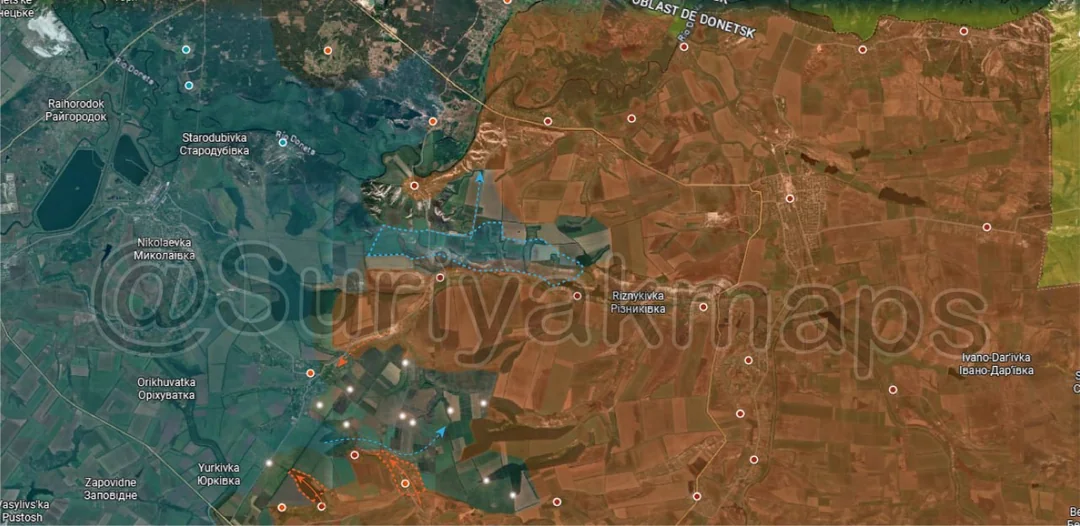
Onto the Slovyansk front, Suriyak has made a correction for the area north of Kalenyky and Riznykivka, showing Ukraine still having some isolated troops in some of the trenches along the small ridge. Details are sparse on these troops but I do believe the territory shown as Ukrainian controlled should be an underlayer as they clearly aren’t contesting much of the region (Suriyak has partially walked this back in a more recent map update that I’ll cover next post).

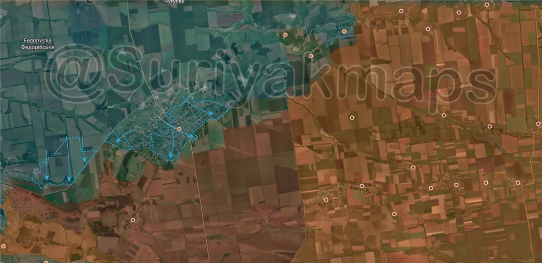
Further south, Russia regained control of Nykyforivka and captured one of the small forest strips north of Fedorivka Druha, but are still having to deal with the Ukrainian infantry spread out in the treelines east of Rai-Oleksandrivka.
Russian Forces Advance: 16.46 km²

Upper Middle Advance = 5.55km2, Middle Advance = 0.26km2, Left Bottom Advance = 9.47km2, Bottom Advance = 1.18km2

Further south on the same front, Russia has once again resecured Minkivka and Holubivka, pushing the frontline back to and over the canal. I wouldn’t rule out Ukraine trying to sneak back into these villages yet again but they will have a harder time now that Russia is assaulting Malynivka and Tykhonivka (where the infiltrators travelled through).

To the southwest Ukraine recaptured some of the treelines near Fedorivka and is attempting to attack the village of Maiske, whilst the Russians have moved into the centre of Markove.
Russian Forces Advance: 28.39 km²

Upper Advance = 7.84km2, Bottom Advance = 20.55km2

Down to the Kostyantynivka front, the collapse in the city has accelerated over the week Ukraine losing control over most of the remaining areas and Russia now securing the large greyzones they have created. Starting on the north side, outside Kostyantynivka Russian troops that had been travelling through Novodmytrivka to reach the northern suburbs of the city have secured the village and are moving deeper into Kostyantynivka, as well as trying to capture nearby Molocharka. Their current focus is on reaching the ‘old town’ portion of the city to encircle the Ukrainian troops that haven’t been able/allowed to retreat yet.

On the other side of the river Russia has been quickly expanding their control of the industrial areas, central highrise district and are also moving out into the streets in northwestern Kostyantynivka. The mapping here is a little inaccurate as there is still some greyzone south of the river where isolated Ukrainian soldiers remain (will be shown in next update), but there is little they can do to stop the Russians. Rather than split out individual videos I’m going to put them all here as there are so many clips of them showing the Russians across the entirety of Kostyantynivka there is little doubt as to their presence (video 1, video 2, video 3).

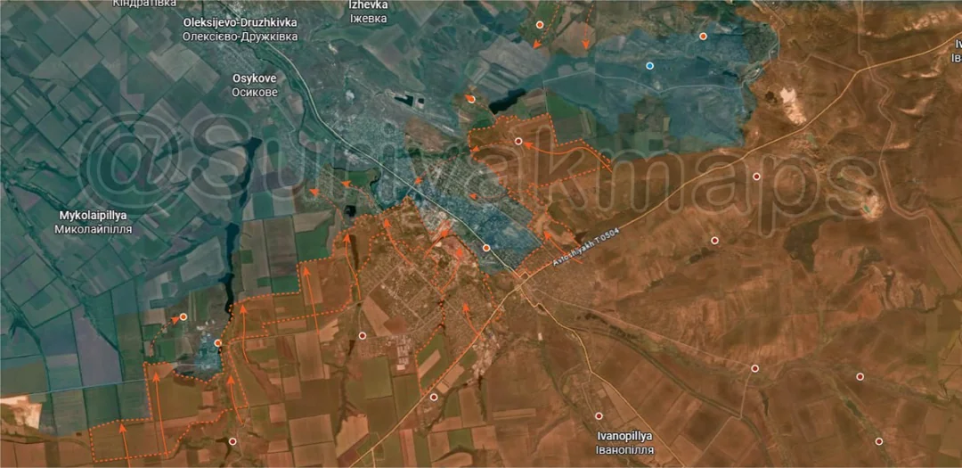
West of the city Russia has also taken advantage of the chaos and collapse to push north through the fields, capturing a wider area of treelines and moving into Dovha Balka and Rozkishne. Russia claims to control both of them already although this is disputed, so Suriyak has put them in the greyzone for now. If they can secure these villages it will open the way for a deeper push north towards Mykolaipillya, which is necessary for building the western flank for an attack on Osykove.
Russian Forces Advance: 9.38 km²

Advance = 9.38km2

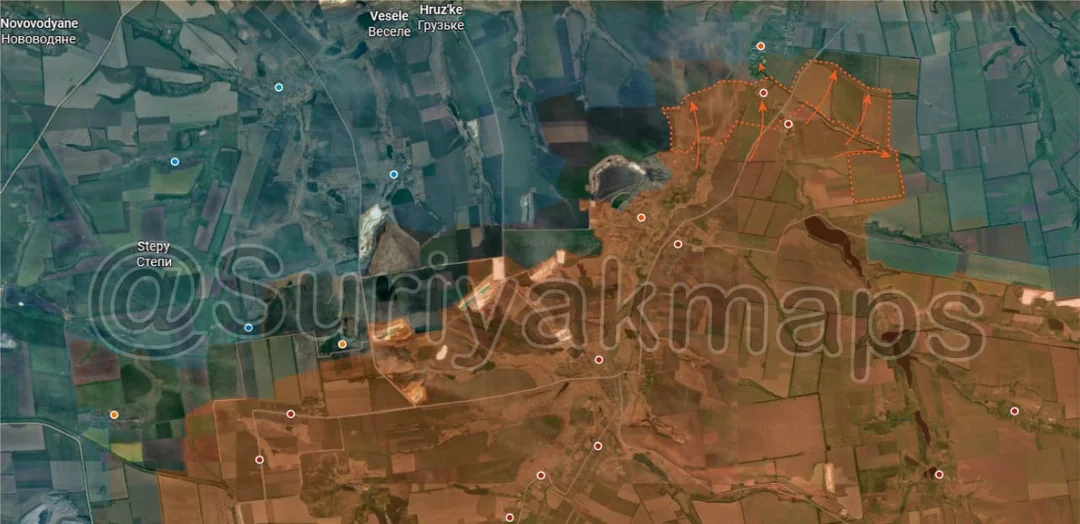
Moving to the western edge of the same front (soon to be the Druzhkivka front), after extended clashes Russia reportedly managed to capture the village of Pavlivka and many of the treelines around it. They’ve also secured some of the trench networks north of Toretske, so it should be possible for them to attack Pryyut to the north (not guaranteed though).
Russian Forces Advance: 24.45 km²

Top Right Advance = 2.48km2, Upper Right Advance = 3.59km2, Middle Left Advance = 12.20km2, Middle Advance = 1.60km2, Left Advance = 4.58km2

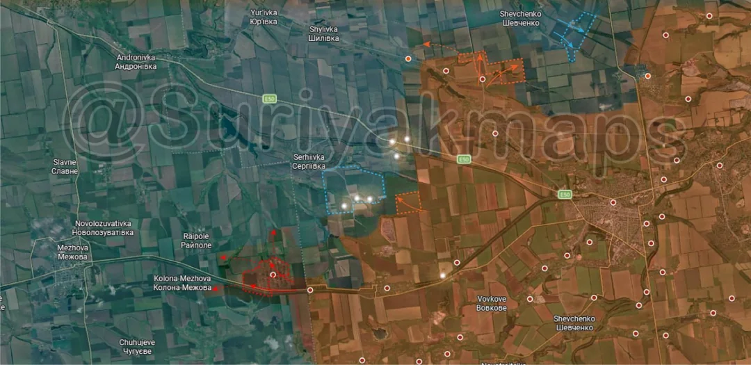
Heading to the Pokrovsk front, on the northeast side Ukraine has resecured the mine east of Shevchenko, whilst Russia pushed closer to the villages from the southwest.

To the southwest, the large greyzone that formed after Russian DRGs were spotted near Serhiivka some time ago has been put back under Ukrainian control, as clashes and shelling continue outside the town.

Southwest again, Russian assault groups captured Novopidhorodne and are currently trying to move out into the nearby treelines to expand the buffer around the village. Their control here is quite weak (few troops) so it is certainly possible that Ukraine may attack and try recapture the locality, although it isn’t guaranteed.
Ukrainian Forces Advance: 14.90 km²

Left Advance = 7.84km2, Lower Left Advance = 0.87km2, Bottom Left Advance = 6.19km2

Onto the Novopavlivka front, Ukraine has recaptured almost all of the town after the Russian attempt to assault it in early May. Most of the locality is so badly damaged there are hardly any viable positions left here, hence the difficulty both sides have had in holding and advancing here, so Ukraine will need to push out into the fields if they wish to properly secure it.

They’ve also moved back into the greyzone west of the town, taking up positions in the treelines.
Ukrainian Forces Advance: 26.82 km²

Top Advance = 7.72km2, Middle Right Advance = 4.93km2, Bottom Left Advance = 14.17km2

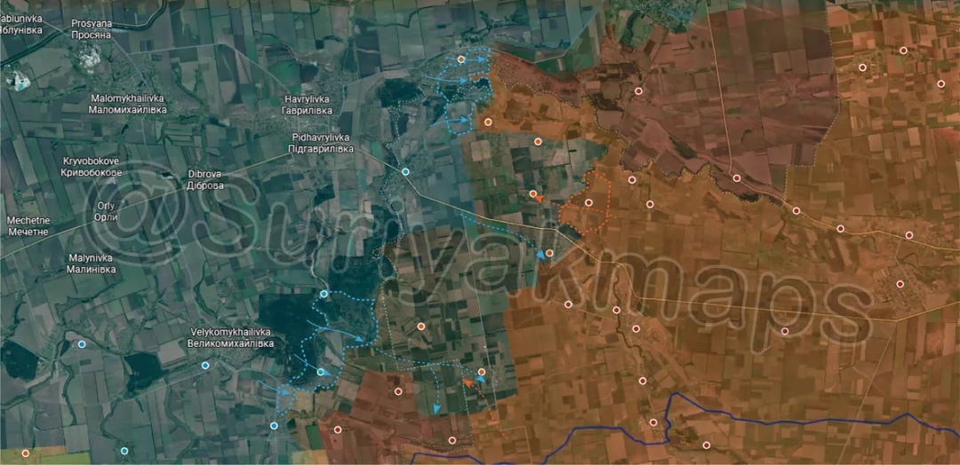
Over to the northeast side of the Pokrovske front/Novopavlivka front, to the north Ukraine has continued to push in Ivanivka following Russian withdrawals east. The town will likely be recaptured as Russia will want to avoid being cut off here if they tried to hold, however they will try maintain their presence north of the Vovcha River so they can attack it again in the future.

Nearby Russia quickly reestablished control of Zirka after Ukrainian infiltrations a few weeks ago and have also been pushing out into the area west of the Mokri Yaly River. This is part of the problematic mixed control/infiltration space here, with Russians still demonstrating presence in many of the areas marked greyzone here, adding to the confusion.

To the southwest, Lisne has been marked back as under Ukrainian control again following the Russian infiltration in early June (shouldn’t have been made greyzone in my opinion) and they have also moved into Novoselivka and are trying to consolidate there.
Ukrainian Forces Advance: 42.25 km²

Upper Right Advance = 2.32km2, Lower Left Advance = 37.49km2, Lower Middle Advance = 2.53km2

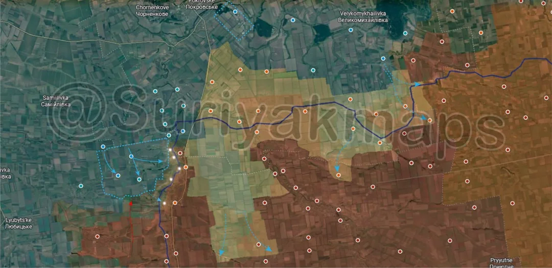
Moving to the main section of the Pokrovske front, on the east side Russia recaptured Berezove, although infiltrations and clashes continued in and around this village.

Out west Ukraine finally managed to drive the Russians out of Ternuvate, Kosivtseve and Prydorozhnje after months of clashes and assaults, recapturing these localities. They are now trying to push onto and retake the fortifications next to the Haichur River, where Russia is attempting to hold so they can push back to Ternuvate.
Ukrainian Forces Advance: 11.46 km²

Top Advance = 9.34km2, Bottom Advance = 2.12km2

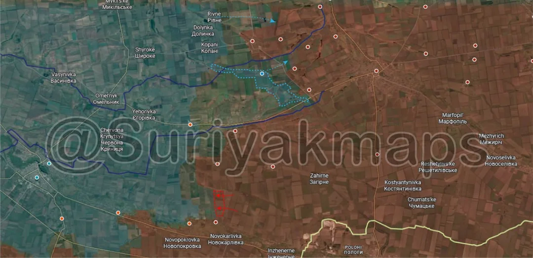
Down to the Hulyaipole front, on the north side Suriyak has made a correction/change showing a stretch of the area along the Verkhnya Tersa River (really a small stream) and the village of Hirke as being under Ukrainian control, all the way out to Zaliznychne. I don’t agree with this one being marked as such and believe it would be better to show as an underlayer, as we have had many bits of footage released showing the Russians in these areas and west all the way towards Kopani, so it's clear there is mixed presence of infantry groups from both sides.

To the south there was also a minor Russian advance in a treeline near Luhivske as they try straighten up the front with Bilohirya.