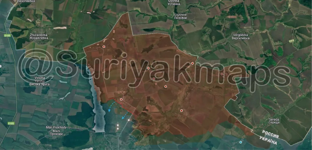
Back home
Post #60

RU POV: Russian and Ukrainian advances from Day 860 of the War - Suriyakmaps

Jul 3, 2024 — Jul 3, 2024 War Day 860–860


A reminder that these maps are confirming updates from yesterday (i.e. 12 to 24 hours delayed).

Ukrainian Advance
0.49 km²
Overall (set): 0.49 km²
Russian Advance
7.53 km²
Net Change
-7.04 km²

Situation Snapshots

Imagery, commentary, and territorial changes from the period.

6 entries
Russian Forces Advance: 0.05 km²

Advance = 0.05km2

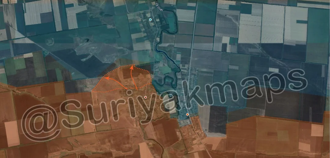
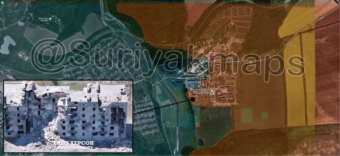
Russian forces have finally captured the western side of the Chasiv Yar microdistrict, after several months of fighting, with their flag being raised in this video. Whilst Russian forces have yet to completely take over the microdistrict, the remaining section has become grey zone as Ukrainian forces have retreated back to their trenches around the canal itself. Russian forces will likely finish clearing the remainder of the microdistrict, before looking to cross the canal.
Russian Forces Advance: 1.51 km²

Advance = 1.51km2

Russian forces captured the last few buildings of Staromaiorske, as well as pushing north and taking one of their old trenchlines. With this, Russia officially controls the entirety of the town. They will likely continue their advance north towards Makarivka, as well as trying to assault neighbouring Urozhaine from behind.
Russian Forces Advance: 2.83 km²

Top Left Advance = 0.06km2, Top right Advance = 1.24km2, Bottom Advance = 1.53km2

Russian forces continued their advance around the reservoir, capturing some more of the fields, and another portion of Karlivka. Russian forces clearing the northern part of Karlivka can be seen in this video. It is only a matter of time before Russian forces capture the remainder of the territory east of the reservoirs, as Ukraine is forced to pull its troops out of that area or risk being wiped out. For now Ukraine still maintains a small presence in the last half of that part of Karlivka, but will likely retreat within the next few days back to defences on the other side of the land bridge.
Russian Forces Advance: 3.14 km²

Top Advance = 0.29km2, Bottom Advance = 2.85km2

Russian forces have advanced slightly towards Vozdvyzhenka (top blue dot), in a somewhat unexpected move. Whilst Russian forces do control Novooleksandrivka (top red dot), they only have a thin area of control in the forests that they are advancing along. Russian forces may try push straight into Vozdvyzhenka, taking advantage of their initiative, or will halt on the outskirts in order to expand control of their flanks before beginning the attack.

To the south, with Sokil captured, Russian forces were able to take over a portion of the fields to the south, and are currently closing in on the town of Novoselivka Persha. It is possible that Russia may be able to surround the town from 3 sides, as they are also advancing towards it from the south from Umanske (just off bottom of map).
Ukrainian Forces Advance: 0.49 km²

Top Advance = 0.06km2, Bottom Advance = 0.43km2

On the Kupyansk front, some small corrections have been made, showing Ukraine currently controls a small segment of the forest next to Tabaivka (previously grey zone), as well as still holding a treeline near Berestove they were thought to have been driven out of. With regards to the latter, Ukraine may still hold that area, but will likely lose it in the future due to the risk of being encircled.
Context Advance: 0.00 km²
In the north, the situation has not gone as well for Ukrainian forces around Lyptsi, as it has for those in Vovchansk. After several weeks of assaults on Russian positions around Hlyboke (red dot), they have been forced to retreat, ceding some territory to the grey zone. Ukrainian forces have lost a number of vehicles in this area, most notably several BTR-4Es, which Ukraine has very few of left.